
Project information
- Name: Movement Patterns of Pristina
- Creation date: 27th April, 2025
- Software: ArcGIS Pro, PostGIS, JOSM
- Source: Esri, OCHA, OpenStreetMap Public GPS Traces
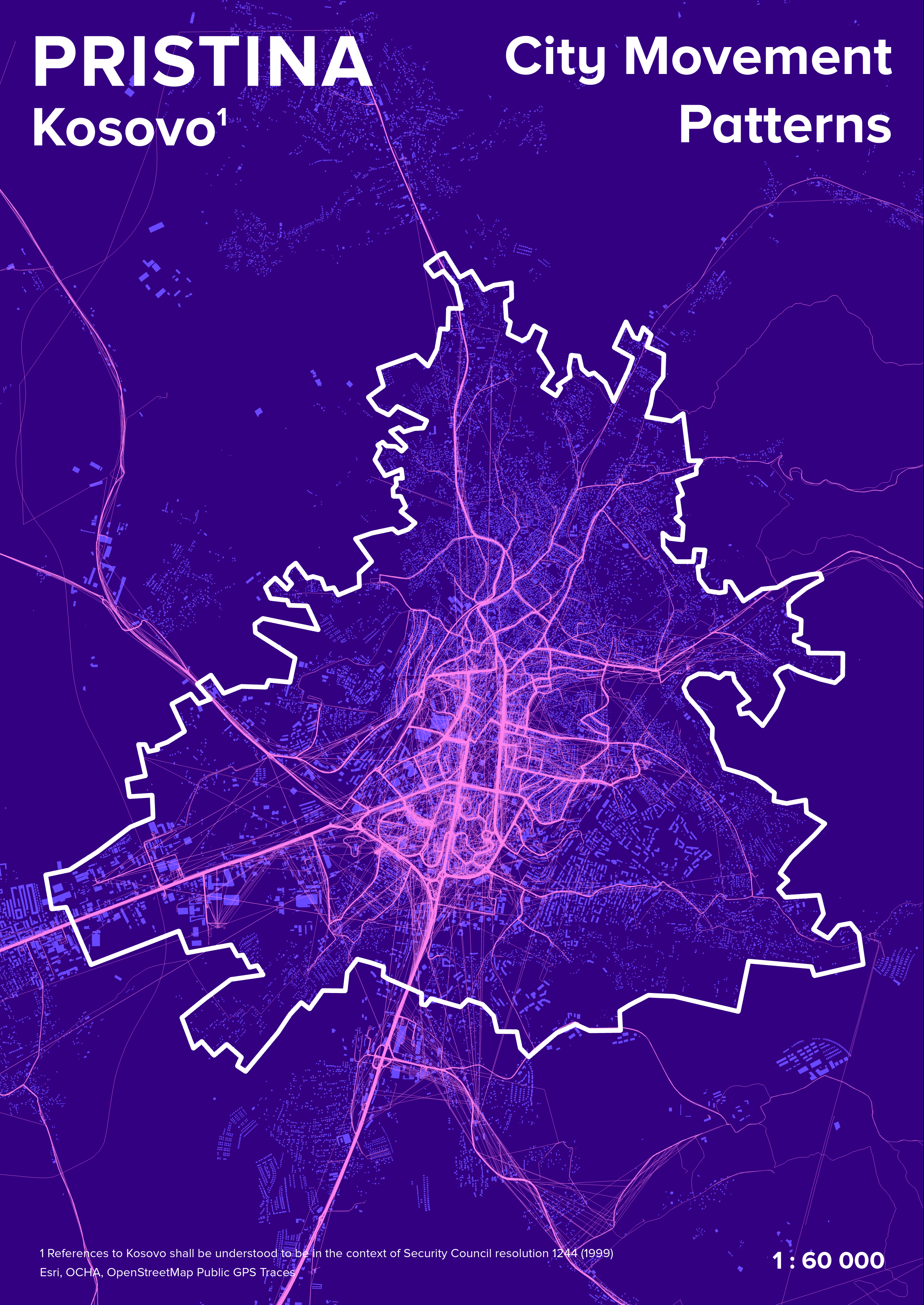
- Description: The map offers an illuminating visual representation of how people move throughout the capital of Kosovo. The visual contrast between dark and bright lines reflects the urban pulse of Pristina—its most traveled paths, intersections, and zones of activity.
- From the map, we observe that movement is most concentrated in the central region of the city, where major roads converge. These central routes form a dense network of activity, indicating that this area likely contains key infrastructure—government buildings, marketplaces, transport hubs, or cultural centers—that draw people throughout the day. The brightness of these paths suggests constant movement, from both vehicles and pedestrians.
- Extending outward from the city center, movement corridors radiate in several directions, connecting Pristina to outlying neighborhoods and nearby towns. These high-traffic arteries show how residents commute between central and peripheral areas. Notably, there are several strong lines leading south and southwest, which indicate a major route or highway. Conversely, the movement patterns in the northern and northeastern edges of the city are sparser, hinting at less urbanized or less frequently visited areas.