
Project information
- Name: Pljevlja Elevation Map
- Creation date: 5th Feabruary, 2025
- Software: ArcGIS Pro, PowerBI, Excel, Adobe Illustrator
- Source: Esri, OCHA, OSM, GISCO EU-DEM
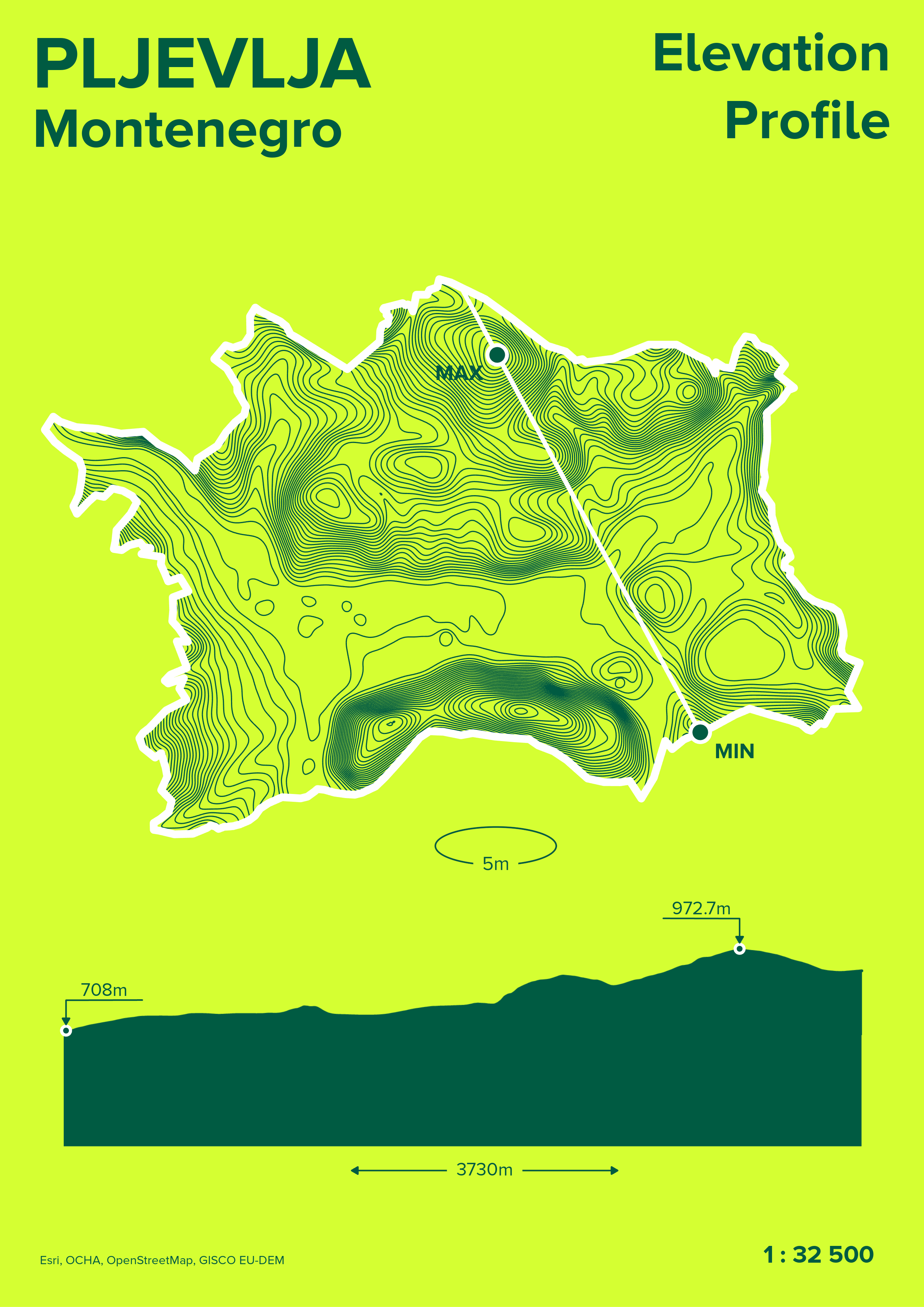
- Description: Pljevlja is nestled in a rugged valley of northern Montenegro, with elevations ranging from 708 meters to 972.7 meters. The 264.7-meter variation creates a mix of steep slopes and plateaus, shaped by the Tara and Ćehotina river systems. The southeastern part of the city is dominated by the Pljevlja Coal Mine, whose terraced pits and waste piles artificially modify the local topography. Active since 1960, the mine's excavations have created depressions and artificial ridges visible in elevation models. The highest point (972.7m) corresponds to the surrounding Dinaric Alps foothills, while the lowlands follow river valleys. The city center clusters in mid-elevation zones (⁓800m), avoiding both flood-prone lowlands and steeper highlands. Coal dust from mining may occasionally blanket lower elevations, which could affect local microclimates.